
How the City of Helsinki tracked drone operations with Dronetag Scout

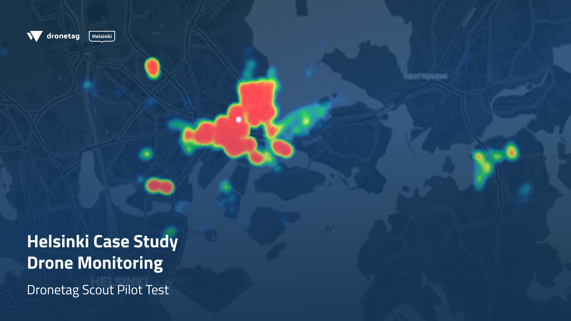
Between December 2024 and March 2025, the City of Helsinki partnered with Dronetag to run a pilot project aimed at better understanding drone activity in its urban airspace. Using a single Dronetag Scout unit with dual omnidirectional antennas, officials monitored Remote ID broadcasts from a coastal location near the city center. A zone that combines both municipal and private drone activity.
Despite winter conditions limiting overall usage, the Scout detected 150 drone flights during the trial period. Most flights were recorded on Tuesdays and Wednesdays between 8:00 AM and 2:00 PM, reflecting workday operations. Notably, 13% of flights exceeded the EU altitude limit of 120 meters, with one reaching 231.5 meters.
The data also showed that 98% of detected drones were DJI models, with the Air 3 being the most common. Another key finding was that 87% of drones did not include a UAS Operator ID, despite regulatory requirements, underlining the need for improved compliance monitoring.
The pilot provided the City of Helsinki with valuable insights into local drone behavior, highlighting trends in flight times, altitudes, and operator practices. By leveraging Dronetag Scout, Helsinki demonstrated how municipalities can use Remote ID technology to increase airspace transparency and prepare for the safe integration of drones into city environments.
Download the full case study (PDF)
Get your Dronetag Scout and detect nearby drones instantly.
.svg)
