
Professional Apps for Airspace Awareness
Our software ecosystem offers the right tool for every mission. Whether you need a central command dashboard, a quick handheld scanner, or a deeper-level diagnostic utility, we have you covered. Access critical data on iOS, Android, and Web to manage fleets, ensure compliance, and secure the skies.

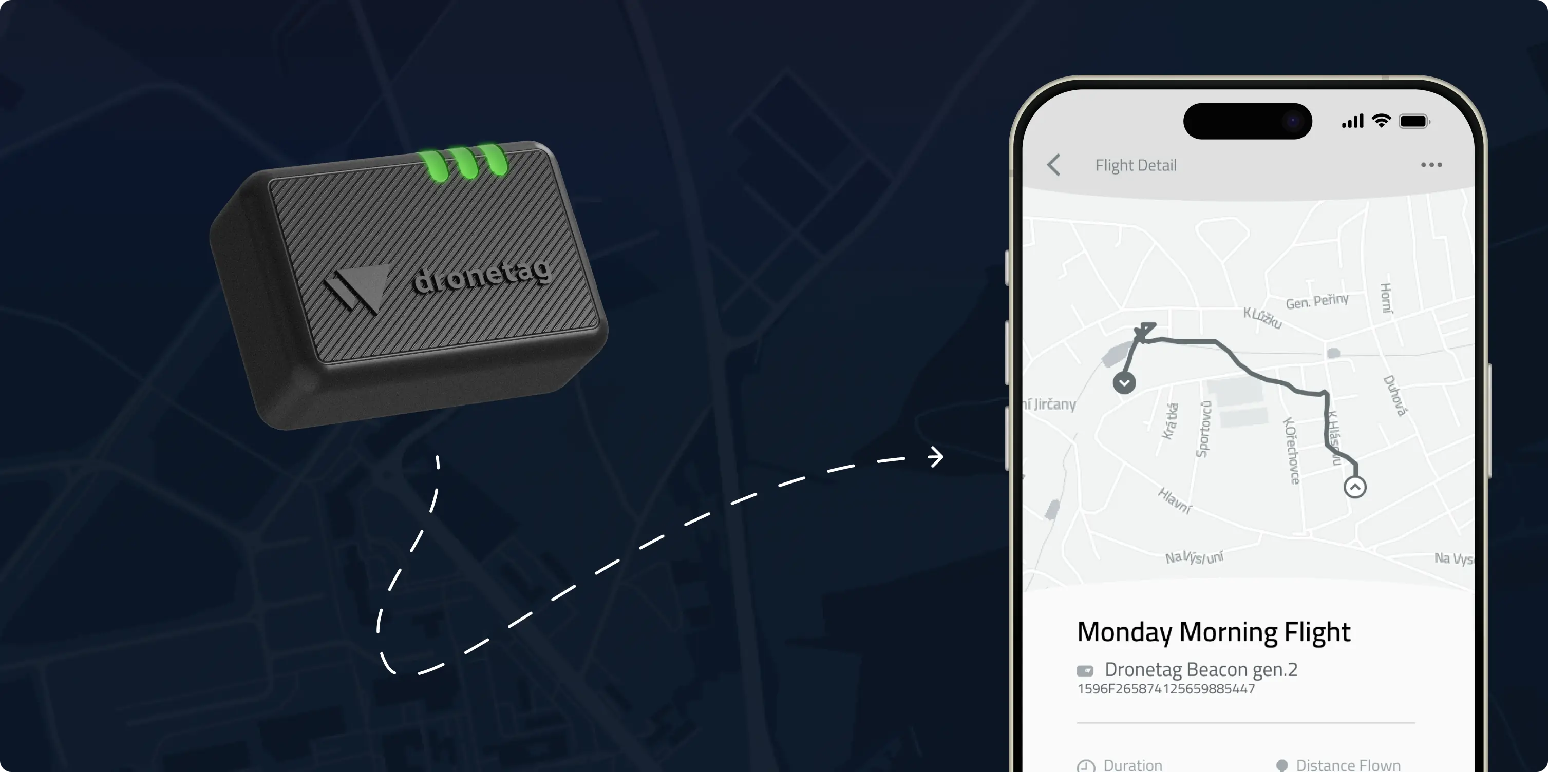
Dronetag
App
The Dronetag App is the central hub of our ecosystem. It transforms complex data from our receivers and transmitters into a single, intuitive dashboard, giving you complete control over your missions and airspace.
Take Control
of the Chaos
Managing a fleet or securing airspace without a unified picture is like flying blind. You need to know where your drones are, who else is flying nearby, and if they are compliant. Our platform solves the pain points of fragmented data by bringing detection, tracking, and management into a single, seamless interface.
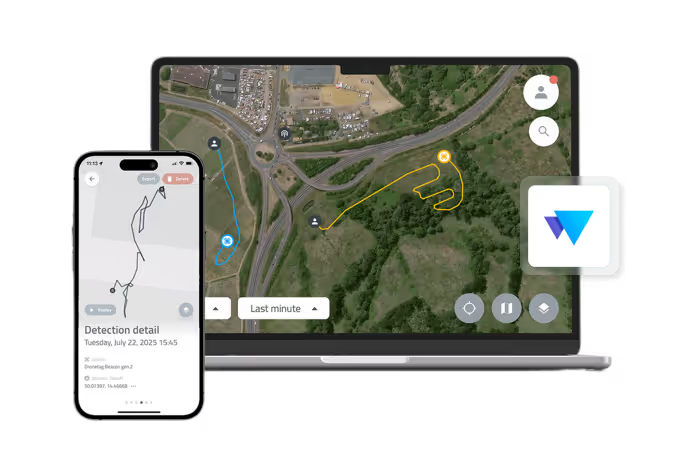
Unified Airspace Picture
The whole operational picture on a single map. Visualize your fleet alongside detected traffic to maintain situational awareness and avoid conflicts.
Complete Device Management
Configure all your Dronetag hardware, update firmware, monitor battery life, and check GNSS status for your entire fleet from one place.
Flight Logging & Replay
Automatically log all flights and detections for compliance. Replay historical missions and export data for post-mission analysis and reporting.
More resources for the Dronetag App
Integration
Our platform is built to be open. Use our powerful REST & WebSocket APIs to feed live detection and telemetry data into your existing UTM or C-UAS dashboards.
Show details
Functions in Detail
Explore the Dronetag App features in detail to see exactly how each function works.
Show details
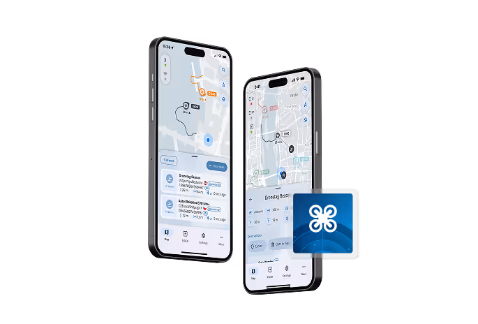
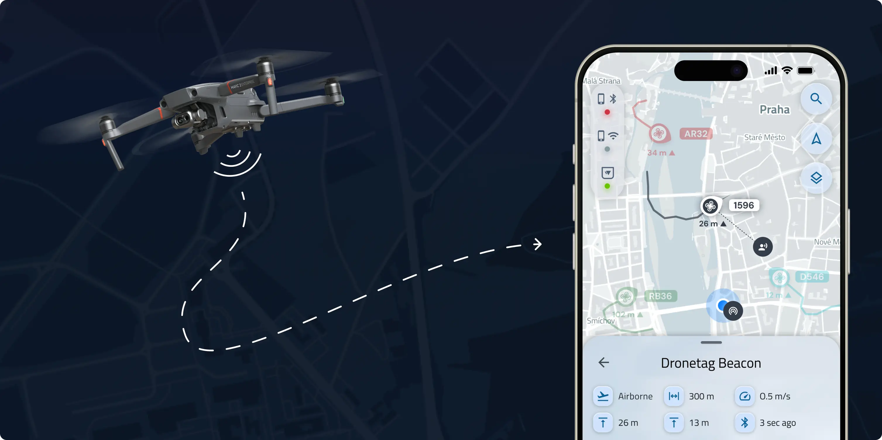
Drone Scanner
Turn your phone into a detection device. Drone Scanner is an app for anyone who needs quick, on-the-spot awareness without complex hardware. It allows you to check if the drone buzzing overhead is compliant and safe.
Free
Airspace Scanner
Drone Scanner uses your phone's Wi-Fi and Bluetooth hardware to read Remote ID data directly from nearby drones. It’s the easiest way to see what's flying around you, for free.

More resources for Drone Scanner
Compatibility
Works with all standard Direct / Broadcast Remote ID protocols (Bluetooth 4/5, Wi-Fi Beacon, Wi-Fi NaN), detecting drones from major manufacturers like DJI and Autel.
Show details
Useful guides
Learn how to interpret Remote ID data and use the Drone Scanner effectively for field checks and casual monitoring.
Show details
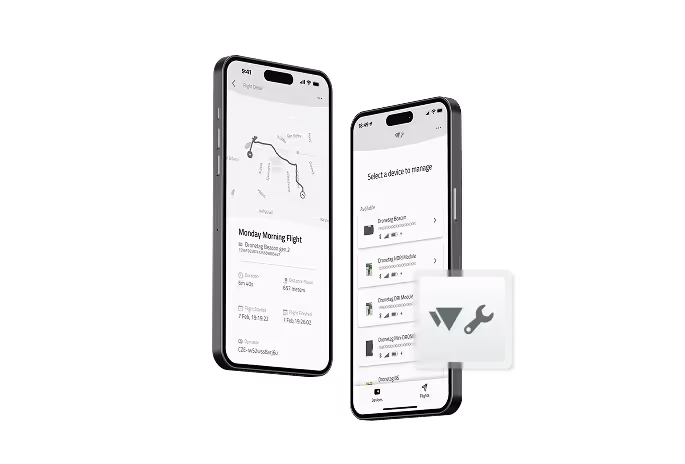
Dronetag Toolbox
Sometimes you need to go deeper. Toolbox is designed for OEM integrators, drone manufacturers, and advanced users who need low-level access to their hardware configurations.
Advanced Configuration
With Dronetag Toolbox, dive into advanced configurations hassle-free. This utility is for deep-level setup, diagnostics, and custom integrations (e.g., MAVLink settings).
Take Off with Dronetag Now
Whatever your airspace needs, we’ll help you find the right setup from hardware to integration.
.svg)
