
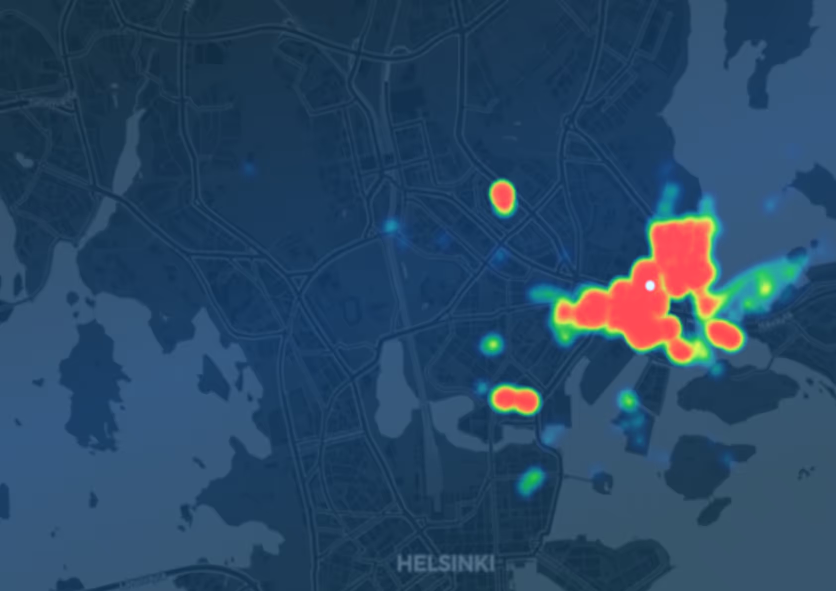
150 distinct flights detected

Clear temporal hotspots revealed

Most common drone models assessed

Remote ID compliance gaps revealed

This report summarizes the findings from a joint pilot project between Dronetag and the City of Helsinki, conducted between December 2024 and March 2025. The primary objective of this pilot was to gain operational insights into drone activity across Helsinki's urban airspace. By passively monitoring Remote ID broadcasts, the project aimed to assess the scale, behavior, and patterns of drone traffic in a real-world city environment.
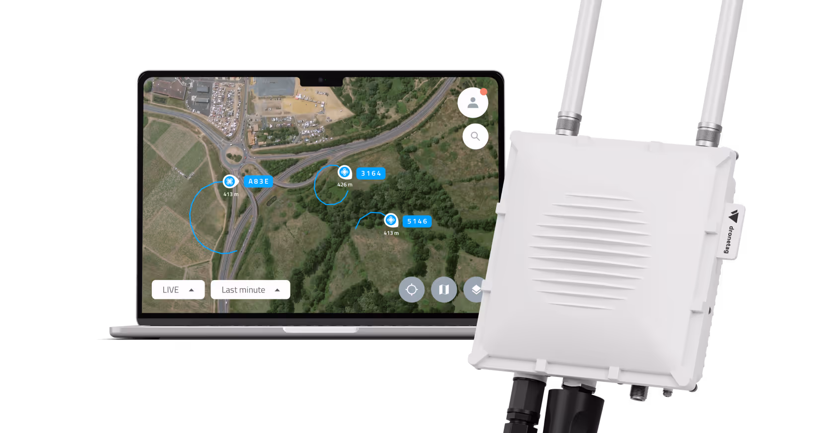
The deployment used a single Dronetag Scout unit equipped with dual omnidirectional antennas, installed in a coastal area near the city center - a zone characterized by mixed-use airspace and relevant to both municipal operations and private drone activity. While the winter season saw lower-than-average drone usage due to weather, the data still offered valuable indicators of usage density, pilot behavior, and typical flight zones.
1
150 distinct flights detected
On average, 2 drones were detected each day. On the busiest day as many as 8 drone flights were recorded.
2
Clear temporal hotspots revealed
The highest drone activity was observed on Tuesday and Wednesday; the most popular time of day was between 8:00-9:00 in the morning.
3
Most common drone models assessed
The most frequently detected drone type was DJI Air 3. We were able to determine the drone type in 98% of detections.
4
Remote ID compliance gaps revealed
87 % of flights were missing a UAS Operator ID.
5
Actionable evidence for future U‑space planning
The test provided Helsinki with its first quantitative baseline of low‑altitude drone traffic.
.png)


.svg)
